


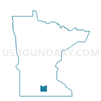
Mapleton Voting District, Blue Earth County, Minnesota
About
Outline

Summary
| Unique Area Identifier | 601282 |
| Name | Mapleton Voting District |
| County | Blue Earth County |
| State | Minnesota |
| Area (square miles) | 1.46 |
| Land Area (square miles) | 1.46 |
| Water Area (square miles) | 0.00 |
| % of Land Area | 99.83 |
| % of Water Area | 0.17 |
| Latitude of the Internal Point | 43.92595170 |
| Longtitude of the Internal Point | -93.95404040 |
Maps


Graphs
Select a template below for downloading or customizing gragh for Mapleton Voting District, Blue Earth County, Minnesota


Neighbors
Neighoring Voting District (by Name) Neighboring Voting District on the Map
- Beauford Twp. Voting District, Blue Earth County, MN
- Mapleton Twp. Voting District, Blue Earth County, MN
Top 10 Neighboring County Subdivision (by Population) Neighboring County Subdivision on the Map
- Mapleton city, Blue Earth County, MN (1,756)
- Beauford township, Blue Earth County, MN (406)
- Mapleton township, Blue Earth County, MN (310)